Helicopter
Aerial
Photography.
For projects in Melbourne’s CBD, Docklands and controlled airspace corridors where drones cannot fly. All flight planning and airspace approvals handled as part of the job.
Get a Quote View Work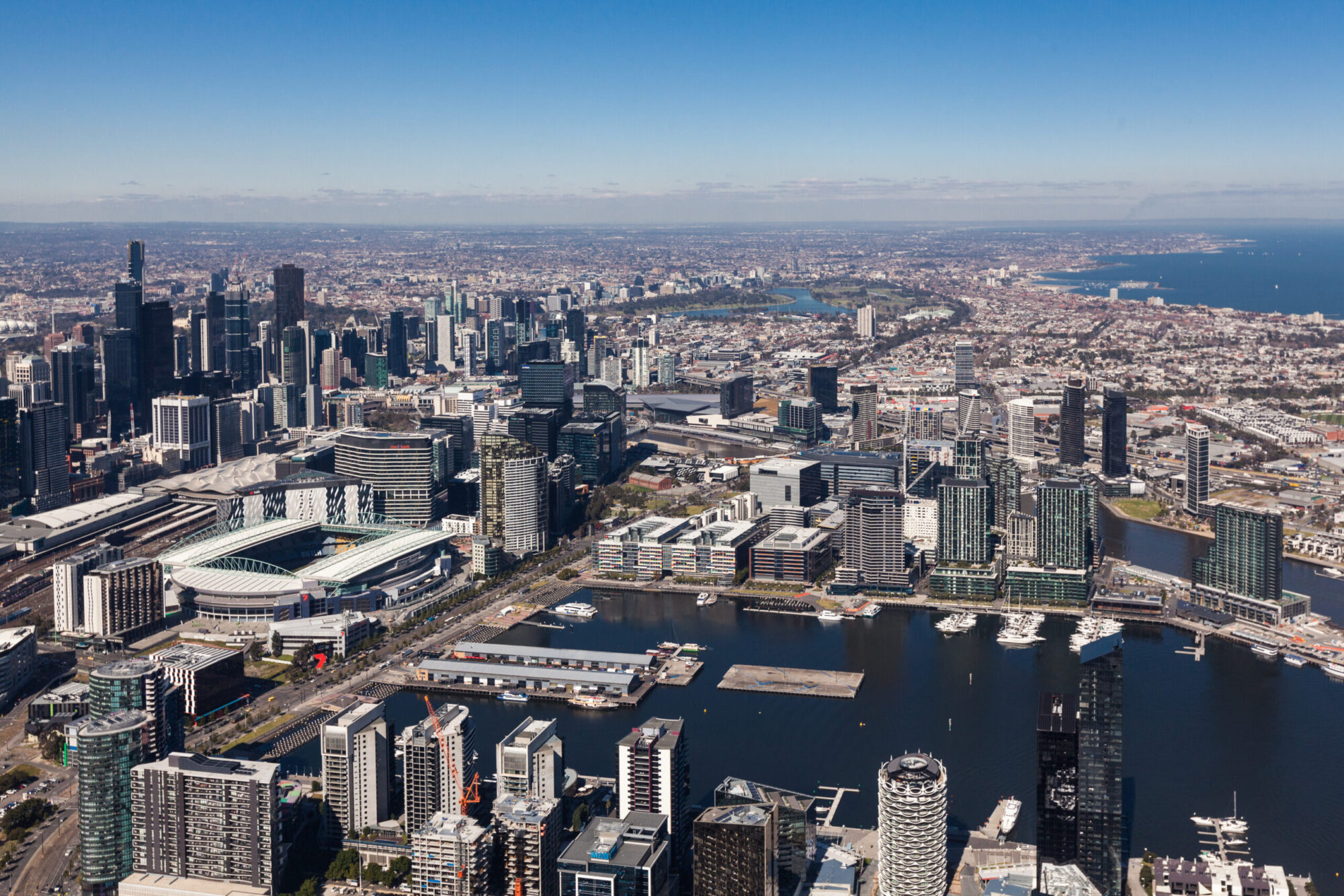
Not every aerial job is a drone job.
If your project sits within Melbourne’s controlled airspace, over the CBD, near the port or across a restricted urban corridor, you need a helicopter and a photographer who knows how to work from one.
I handle all flight planning, airspace approvals and weather windows. On the day, the focus stays entirely on the composition and the specific details of your project.
Airspace drones can’t reach.
CASA restricts drone operations across Melbourne’s CBD, near aerodromes and in many urban corridors. A helicopter operates under a completely different regulatory framework. With a licensed pilot and full ATC clearance, we can fly where drones are grounded.
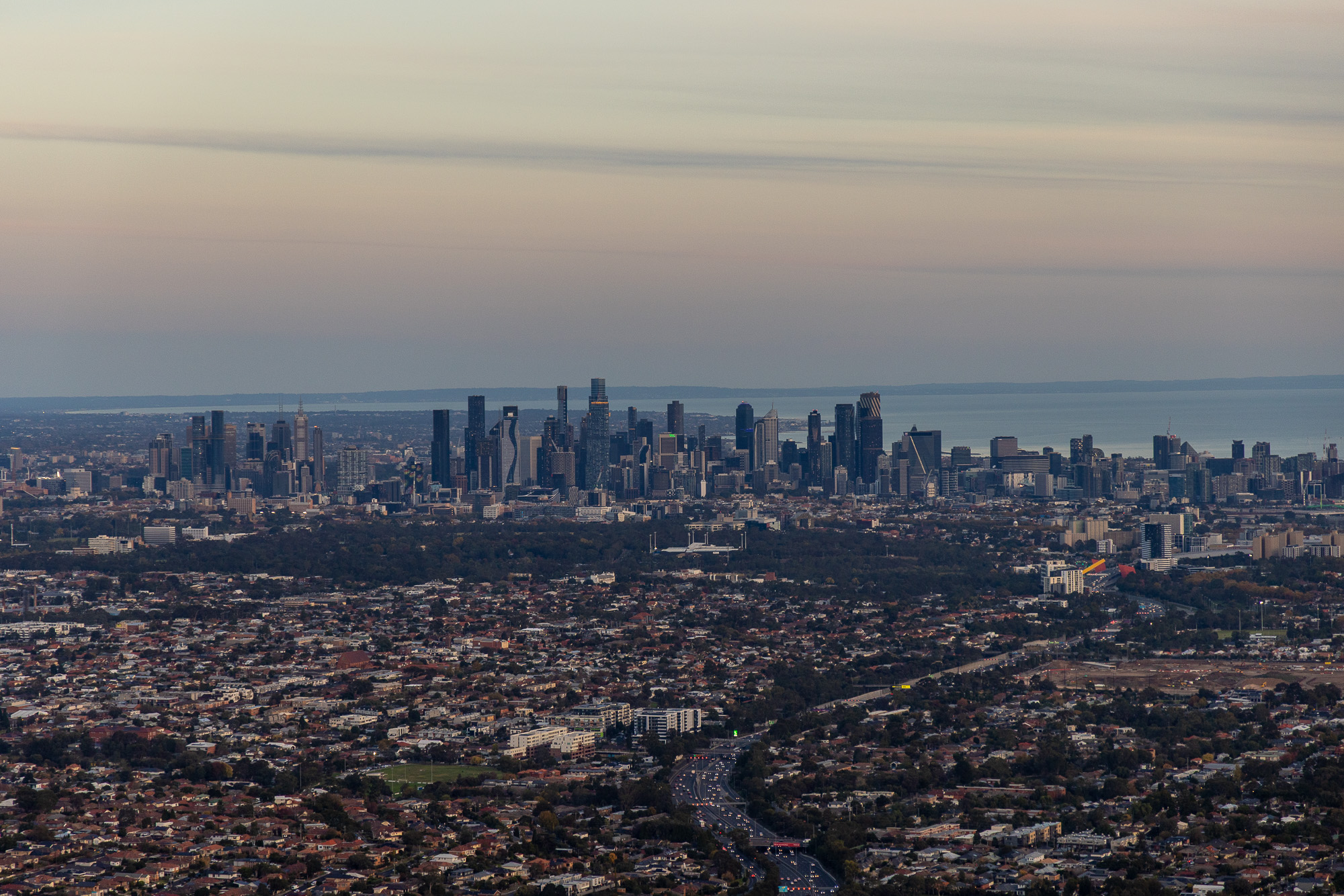
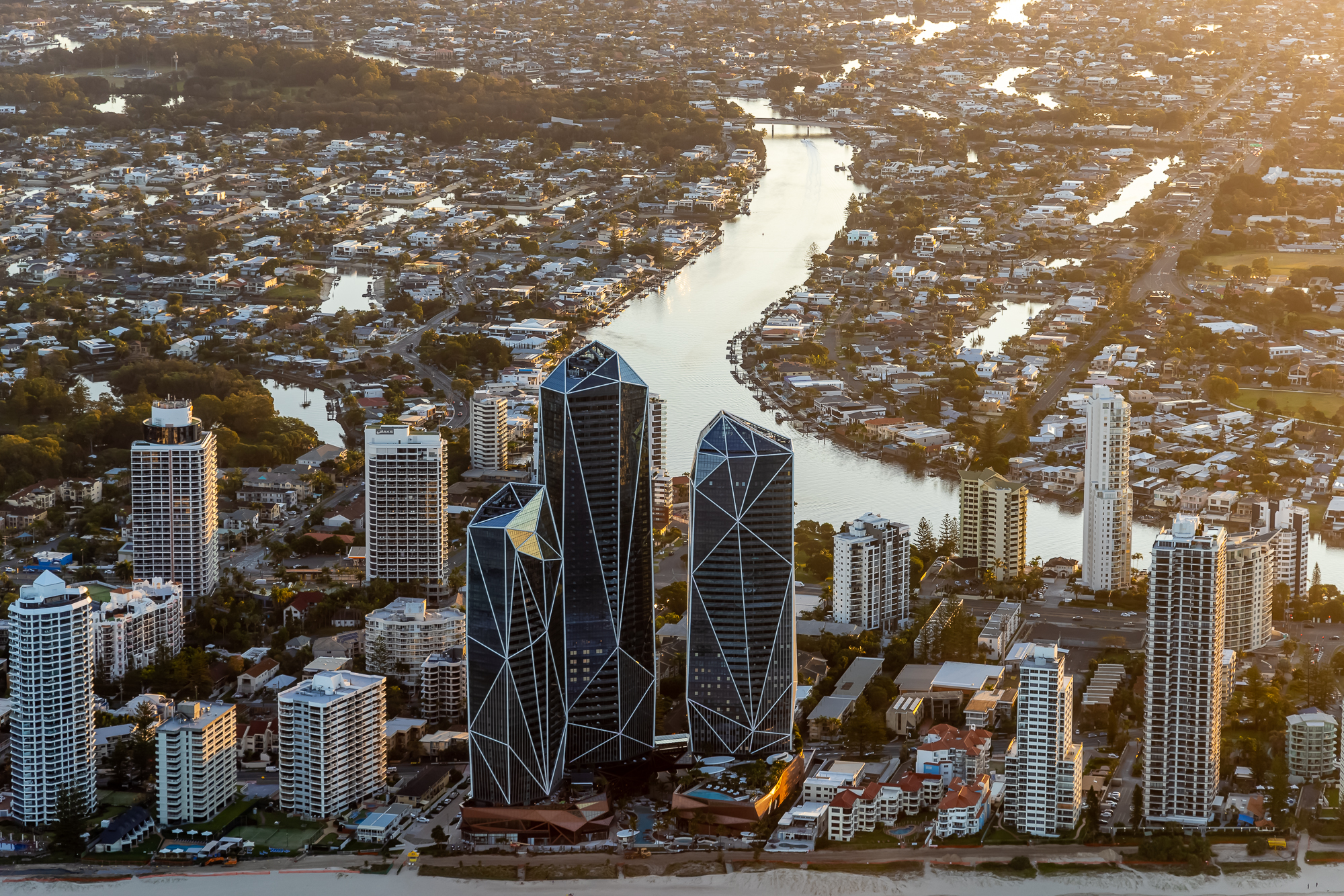
Melbourne’s CBD, Docklands and Port precinct require full ATC clearance for any aerial photography. For architects, developers and commercial clients who need imagery that shows the scale, context and urban positioning of a project, helicopter is the only option.
What commercial helicopter photography is used for.
01
Architecture & Major Developments
Major developments, landmark buildings and urban precincts at scale. From the altitude needed to show the full context of a project in its surroundings.
02
Cityscapes & Skylines
Melbourne CBD, Docklands and surrounding urban areas. Controlled airspace access that drones cannot replicate, at heights that reveal the full city.
03
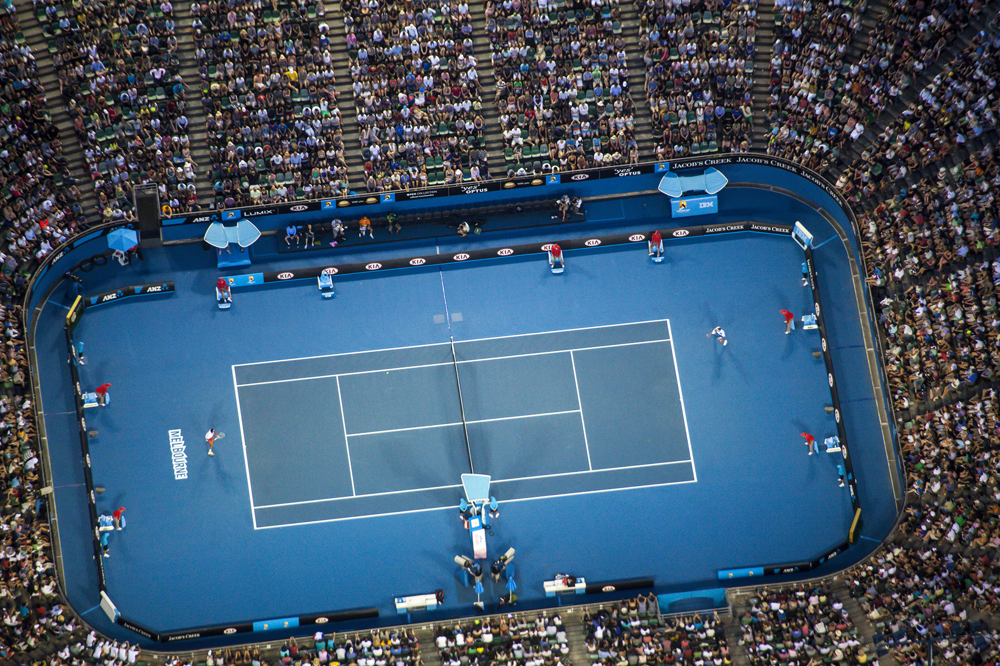
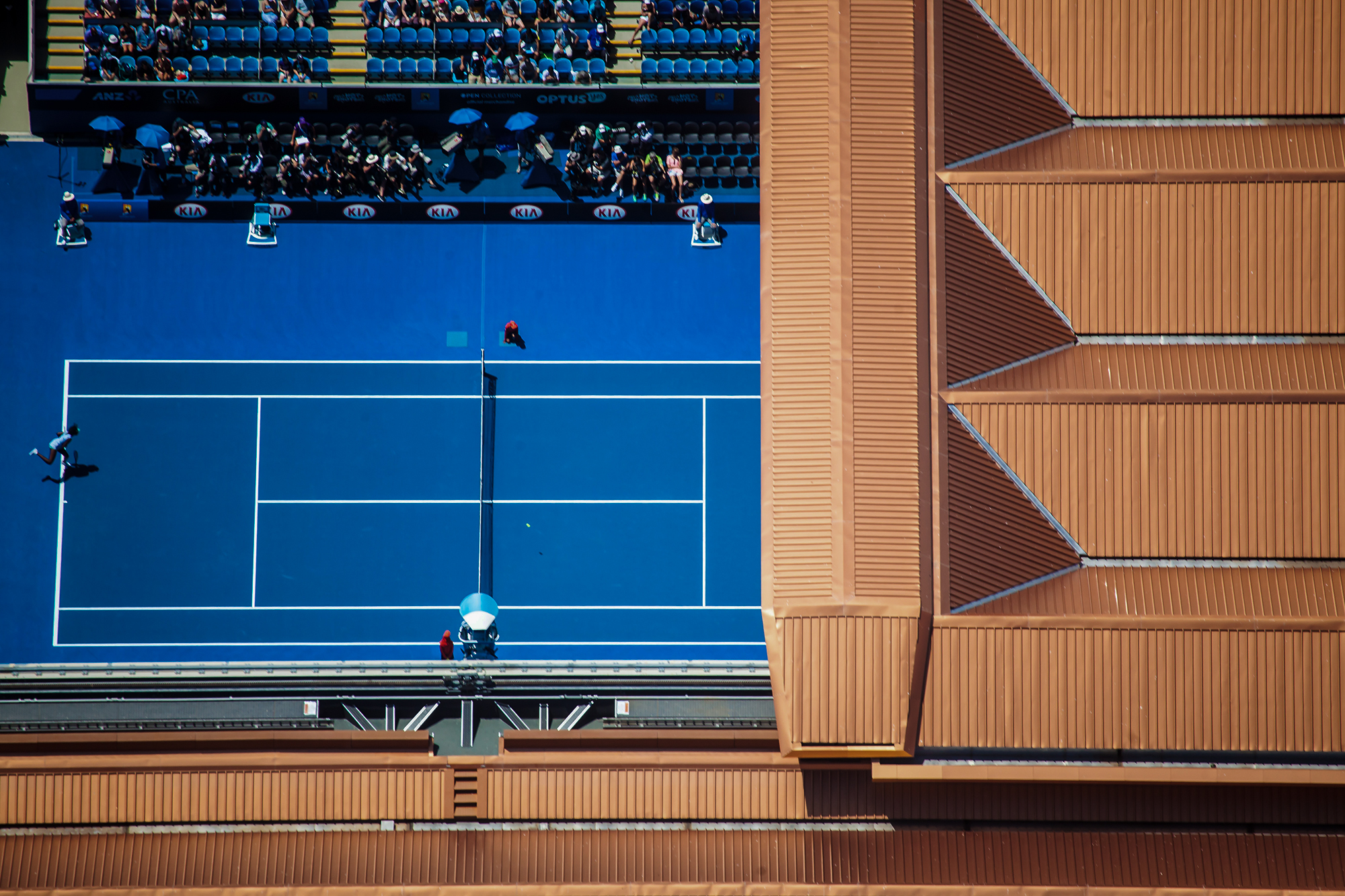
Major Venues and Sporting Precincts
Aerial coverage of major venues including the Australian Open and MCG precinct. Imagery used for venue marketing, broadcast, event promotion and destination campaigns. Requires dedicated airspace approval and pre-event coordination.
04
Property Marketing & Development
At helicopter altitude, a development site can be shown in full context alongside the CBD, key infrastructure and surrounding amenity. The imagery gives marketing teams and agencies material that drone coverage cannot produce.

Talk to Brett about your project.
0403 734 402
Direct line to Brett