Aerial photography provides a clear and accurate view of a site that cannot be achieved from the ground.
I provide professional aerial photography across Melbourne and regional Victoria, working with developers, construction companies, councils and infrastructure projects to document sites at scale.
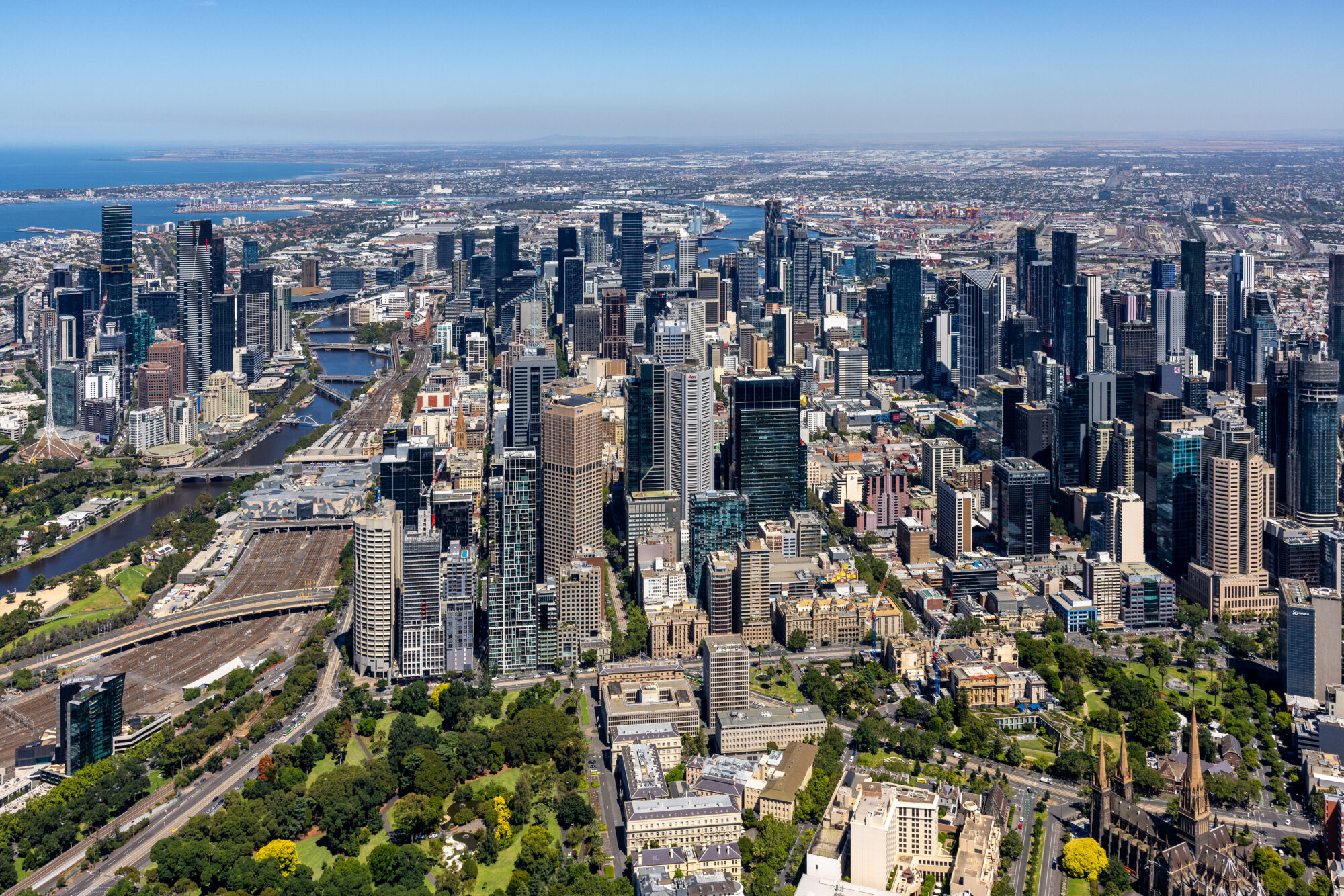
Using fixed-wing aircraft, I capture high-resolution imagery designed for planning, marketing and long-term documentation.
THE ADVANTAGE OF ALTITUDE
While drones are effective for low-level work, they are limited by altitude, battery life and airspace restrictions.
Fixed-wing aerial photography allows full coverage of large sites, city-scale developments and infrastructure corridors in a single flight. It provides a broader context and a level of consistency that is difficult to achieve with smaller platforms.
Flying at higher altitudes also allows access to controlled airspace over ports, CBD areas and restricted zones where drones cannot operate.
PRECISION AND CONSISTENCY
Each flight is planned to ensure consistent angles, repeatable positions and accurate coverage.
This is particularly important for projects that require ongoing documentation or comparison over time. By maintaining consistent flight paths and reference points, I can produce imagery that clearly shows change and progress across multiple stages of a project.
The result is a reliable visual record that can be used for planning, reporting and communication.
APPLICATIONS
Aerial photography is used across a range of commercial applications:
- Property development and site acquisition
- Construction progress documentation
- Infrastructure and transport projects
- Industrial and land-use mapping
- Environmental and coastal monitoring
For lower-altitude capture and detailed site imagery, see Drone Photography Melbourne.
For ongoing project documentation, see Construction Photography Melbourne.
PROFESSIONAL FLIGHT COORDINATION
Every project is managed from planning through to delivery.
This includes flight planning, airspace coordination, weather assessment and communication with pilots and operators. Each job is carried out in accordance with aviation regulations to ensure safe and consistent results.
For organisations managing multiple sites or large-scale projects, this process ensures efficiency and reliability across all deliverables.
WHY WORK WITH ME
I approach aerial photography as both a technical and visual process.
Each project is captured with attention to clarity, composition and consistency. The aim is to produce imagery that is not only visually strong, but also practical and usable across planning, reporting and marketing.
With experience working across large-scale sites, I understand how to capture projects in a way that reflects their true scale and context.
REQUEST A QUOTE
If you need aerial photography for a project, the quickest way to get started is through the order form.
https://brettprice.com.au/orderform/


